Elisabete Martins
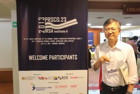
PRSCO 2013 Bandung
General Information
The PRSCO Conference took place in Bandung, Indonesia, from the 2nd till the 4th of July. More than 300 participants from 22 countries were counted. Stupendous organization and sympathy with a very good selection of papers, remarkable keynote speakers and involving social events namely the PRSCO Orchestra of Angklungs.
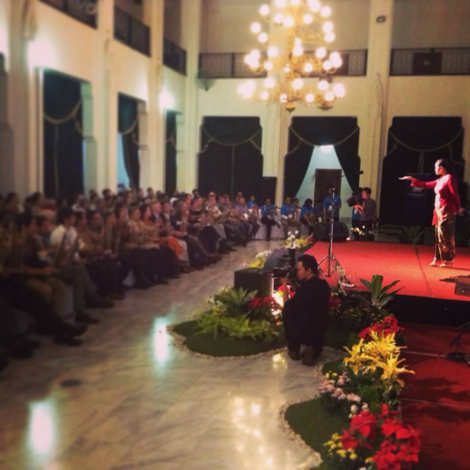
Regional scientists from 20 countries playing angklung in Gedung Sate, Bandung, Indonesia.
The presence of Prof. Armida Alisjahbana, Minister of National Development Planning for Indonesia, of Prof. Iwan Jaya Azis from the Asian Development Bank and of the Rector of Padjadjaran University, Prof. Ganjar Kurmia, among many other well-known regional scientists illustrates the desire of the organization and the participants to respond to global, Asian, national and regional challenges also within the consistent and flexible framework of regional science.
Revealing was the presence of a large number or young scientists with very interesting presentations. Also remarkable was the effective and kind support of the students of the Faculty of Economics and Business of the University of Padjadjaran indicating a very good academic environment. Congratulations to the students and to the Chair of the Local Organizing Committee, Dr. Mohamad Fahmi and to Dr. Nury Effenti, Dean of the Faculty of Economics and Business.

Synthesis of the Plenary Sessions
Entering the Uncharted Territory
Iwan J. Aziz – Head of the Office of Regional Economic Integration (OREI), Asian Development Bank and Professor at Cornell University, USA.
 “Asia is an irony. It has gone through a dramatic turnaround from excess investment during the pre-1997 Asian financial crises (AFC) to excess savings during the post AFC, including the rise of foreign reserve accumulation. Yet, the region is saving huge deficits in social and physical infrastructure….
….Unlike during the Pre-AFC, this time increased capital flows in Asia occur while the region has excess savings. This complicates the issues and poses major policy challenges. Not only gross flows become more important to track than net flows, but the size and types of flows matter a lot…
….The rising volatility of capital flows in the region has not been uniform, and bank-led flows occurred most frequently. This poses more difficult to maintain financial and macro stability…
… First, with a stronger currency as a result of capital inflows, the balance sheet position of borrowers improves, generating an even greater risk-taking in the part of banks and stimulating further inflows through cross-border bank led capital flows…
… Second, the global financial stability can be affected by competitive devaluation. This is the reason why the International Monetary Fund (IMF) needs to set the best course of direction in terms of the type and nature of intervention member countries can take….
…Third, there is a need for cross border bank regulation that has always discussed but progress has been close to none…
…Unlike the goods market, the financial market is a different “animal” , featuring complex interrelations with asymmetric information and high unpredictability that may generate seemingly non-rational decisions by agents…
…In short, the capacity of domestic safety nets needs to be augmented by regional safety nets. In ASEAN+3, the Chiang Mai Initiative Multilateral (CMIM) is already in place, and India has been leading the efforts to set up similar regional financial safety nets for South Asia, does this mean Asia has no reason to worry? Plenty of reasons…
… Financial crisis are explainable but not predictable. Does Asia need one to realize the danger of entering the uncharged territory?”
Socio-Spatial Dynamics of Economic Growth and Development
Jichung Yang – Professor at Seoul University, Korea.
 “There are many factors of economic growth and development: external trade, job creation, education, research and development spillover effects, industrial complexity….
….Regarding the social and economic spatial dimensions economic growth and development increases urbanization, reinforces the interactions between macro and micro levels of the economy, and interacts with the social-spatial dynamics recognizable in congested city infrastructures and cost disparities…
….Furthermore there are new phenomena that will have strong interactions with economic growth and development such as aging population, changing demand, political uncertainty and globalization…
Looking into the relations between urbanization and economic growth and more specifically urban structures and development it is possible to see, form the analysis of different urban agglomerations, that: sectorial clustering has a positive effect on productivity; proximity between companies of different sectors also have a positive effect on productivity; finally, entrepreneurship is also important regarding productivity…
On the other hand there are negative effects on growth such as economic recessions, insufficient job creation, low quality of housing, deceptive urban regeneration strategies…
Sustainable development strategies must be based in: i) stimulate innovation through increased agglomeration of companies beyond factor growth; ii) promote socially responsible investment; iii) coordinate and cure bureaucratic problems; iv) get involved in urban regeneration; v) intervene in the housing market; and vi) address the crises of the welfare state.”
Flying Carpets: transport and urban development
Piet Rietveld – VU University of Amsterdam, The Netherlands
 “Networks grow and fade away. That happened and continues to happen with sea, rail, telegraph, pipelines, road and air networks. Cities usually have more than one top situation along time and are more persistent than networks; nevertheless it is possible to have extreme cases of continuous city growth and monotonous city decline….
There is a long term decrease in costs of maritime transportation (Crafts and Veneables, 2001) and all transport costs have decreased substantially; according to the new economic geography model this has implication for the urban size with decreasing transport costs leading to increased urban concentration up to a point where decreasing transport costs can result in lower concentration of economic activity
According to (Anderson, 1986) there were four logistical revolutions: 1000-1500: reduction of transport costs and trade barriers lead to cities of 100000 inhabitants (Venice); 1500-1800: further reductions and innovations in baking stimulated cities of 800000 inhabitants (London); 1800-2000: even further reductions in transport costs also in land transport, and production technological innovations created cities of 10 million and more inhabitants (Shanghai).
The driving force of the fourth revolution is passenger transport. According to Colin Clark (1958) the internal transport within urban areas evolved influencing the city structure: …1800 – transport costs of agriculture products; …1850 – transport costs for workers; …1920 – trams and bicycles;… 1975 – car and buses; 1975…- stagnation in large cities. What is next: des-urbanization or re-urbanization?
What is the spatial range of agglomeration economies: within one building: walking, elevator; 500 m: walking; 2 Km: walking, cycling, car, public; 20 Km: public transportation, car; 100 Km: car, train; 500 Km: car, air. Furthermore, according to Rice and Veneables (2006) the effect on productivity of doubling working population within travel time is: 3,5% until 30 minutes; 1,5% from 30 to 60 minutes; 0,5% from 60 to 80 minutes; and 0% for more than 80 minutes.
In the last decade urban transportation is conditioning urban development. The importance of vertical transportation is underestimated in transport economics and urban economics. It is important to look at the value of high rising buildings. The safe elevator was invented by Elisha Graves Otis in 1852. The number of skyscrapers is booming (from 549 in 1970 to 9514 in 2010), spreading (from the US to the world) and becoming taller (Dubai, Burj Kalifa, 828 meters high, 2007).
For urban economics, skyscrapers result from the trade-off between costs of land and construction costs. There are three more reasons: agglomeration effects (internal returns within organizations and agglomeration effects between organizations); prestige and view. Based on hedonic framework analysis for three Dutch cities it is shown that building height is positively related to office rents but the marginal benefit decreases until 100 meters height increasing beyond that due to reputation effects. Concluding skyscraper construction is booming and height restrictions may have adverse economic effects and inefficient use of land.
The development of regional CGE modeling for policy analysis: an Australian perspective
Peter B. Dixon– Monash University, Melburne, Australia
 “Wassily Leontief (1936 & 1941) made two great contributions: The input-output table, and the input-output model that uses I-O table [X=(I-A)-1*Y]. CGE modeling [v1 = T*v2] is another form of modeling that uses the I-O table - Started with the work of Leif Johansen (1960) in Norway. CGE emphasizes behavior by individual agents, introduces resource constraints and substitution possibilities and price sensitive behavior.In Leontief’s world (the 1930s) there is high unemployment no upward pressure on prices of primary factors from extra demand. In Johansen’s world (the 1950s) there is full employment upward pressure on prices of primary factors from extra demand. The regionalization of IO and CGE models can be made top-down or bottom-up. This presentation shows two cases: i) One example of top-down CGE modeling: Removal of U.S. import restraints; ii) Another example on bottom-up regional modeling on the water buyback scheme for the Southern Murray-Darling Basin in Australia.
Top-Down Example: Work for the U.S. International Trade Commission by Dixon, P.B., M.T. Rimmer and M.E. Tsigas (2007). It was used an application of the 500-industry USAGE CGE model disaggregating the final demand for commodities facility (Si,s,d) using the Horridge formula, that takes account tradability of commodities, assigns large diagonals for major producers, off diagonals reflects distances between supply and demand regions and the share of supply regions in the national output. The exercise continued by trying to identify the variables that explain the employment results of the CGE model associated with the effects of removal of import restraints: a state index, the existence of ports and vacations (for states with touristic events) explained the results of the CGE. Winner states from the removal of import restrains would be in the US borders: the South and West of the US and also North of the Tennessee Valley.
In the Botton-up regional CGE modeling Each region treated as a separate economy. Commodities flow between regions in response to price signals. Labor and capital flow between regions in response to wage differences, employment opportunities, and profit opportunities. Bottom-up approach required when shocks alter relative costs across regions (Si,s,d) becomes endogenous, and regions have their own taxes, technologies, and resource constraints. The example refers to the assessment of the policy proposed by the Australian government to buy water rights from farmers in the Southern Murray-Darling Basin (SMDB). Model results generate interesting questions and sustain consistent answers: 1) Why does Buyback (and consequent increase in the price of irrigation water) stimulate production of vegetables? Because when water prices are high, growing Vegetables is a better use of irrigable land and water than growing other crops such as Rice. Why does Buyback have a relatively minor effect on farm output in an irrigation-intensive region such as R6 (0.6% contraction, 74% dependence)? Because Grapes and Fruit irrigation are major irrigation industries in Region 6 and these are not as badly effected by Buyback as Rice and other irrigation crops which are barely represented in Region 6. Furthermore, increase in the price of water reduces the rental value of irrigable land.
Notes taken by Tomaz Ponce Dentinho
2013 Beijing Forum: Sub-Forum on Urbanization: Sustainable Planning and Diversity
Beijing Forum 2013
Sub-Forum: Urbanization - Sustainable Planning and Diversity
At the occasion of the Beijing Forum 2013, a sub-forum on Urbanization – Sustainable Planning and Diversity will be jointly organized by the Beijing Development Institute and the Center for Sociological Research and Development Studies of China, Peking University,and the Regional Science Association International (RSAI). The event will take place in Beijing, China from 1-3 November 2013.
Thematic Description
Cities provide habitats for more than half of the world’s population, and the world’s urbanization process has kept an even faster pace with the emergence of the new economy of the 21st century. Cities, as a new social structure, are not only the driving force of the regional economy, but also the decision-making cores for socioeconomic development, with intense concentration of political resources. China is among the countries taking urbanization as one of the development priorities, and it is particularly the case after the 18th National Congress of CPC that set up urbanization as one of the most important areas of governance in the new era. In addition to the industrialization and informatization, urbanization has emerged as another key carrier for building a better welfare of the nation. As the point of departure for economic restructuring and development transformation, urbanization triggered the first wave for major social changes after the economic reform. Through this process, a shift occurred from small-scale urbanization supported by township industry and commerce, to a large-scale urbanization process characterized by the integrated development of clusters of cities as in Changjiang Delta, Zhujiang Delta and Bohai Ring regions. This urbanization trajectory illustrates the diverse development paths of China’s urbanization. For the long run, urbanization will remain a key element in China’s development.
The urbanization-driven development path has changed the way we live. More and more people enjoy modern amenities of urban civilization, but we are suffering the negative impacts from the degraded ecological environments in cities. As we accumulate increasing economic wealth in cities, we have lost the foundation of the economic development –i.e., the ecological wealth, which has become a key factor constraint on sustainable development and resilient societies. Therefore, rebuilding a rational ecological culture to restore our ecological wealth is now the most important measure toward a sustainable development of cities. Successful actions in restoring the ecological wealth will need support from well-designed public policies and urban design principles to reshape participatory and multiple dimensional urbanization modes. This will also need a better integration of urban development elements to shape a new order of the urbanization process. At the same time, the whole urbanization process is also heavily influenced by the accompanying globalization trends, and brings in new dimensions of the complexity of any urbanization process. This raises the importance of expended international communications for better cultural interactions, scientific and technological exchange, and sharing of lessons learnt.
Under the broad context of urbanization in China and the world, the sub-forum will review the best practices and lessons learnt, and look for possible pathways ahead for urbanization. The dialogue will be organized around the core issues of effectiveness of policy instruments and urban planning measures for sustainable city development, and social organization and governance strategies over a long term vision of urbanization. In addition, the discussions will also be extended to concerns for diverse paths for urbanization development in terms of the socio-eoconomic and political processes of urbanization, spatial structure, demographic distribution and the coordination among human activities in cities. The ultimate purpose of such extended discussion will contribute to the rational selection of development paths best suited for individual regions with their own characteristics of economic structure, wealth distribution, human resources and livelihoods. Furthermore, urbanization will not only be depicted through the physical density metrics of social organizational factors, but also in alternative ways that play an important role in redefining the urbanization concept as a socio-economic construct. These are all fields of interests to all stakeholders in urban development.
The dialogue will be open to decision-makers, urban planners and managers, as well as to experts and scholars interested in the subject. Through the policy-science dialogue and scientific and technical presentations and discussions, the sub-forum aims to strengthen the global dialogue and communication to explore healthy urbanization modes, and ultimately build effective, beautiful, and livable cities for all.
The Sub-Forum will have the following tentative topics of discussions:
1)Urbanization and Ecological Culture: Policy-Science Dialogue;
2)The Urbanization Paths: Retrospect and Prospect;
3)Green Urban Planning: Theory and Methods;
4)Diversity of Urbanization I: Rational Choice of Development Roads; and
5)Diversity of Urbanization II: Space, Population and Human Activities
Application Process
The forum welcomes interested scholars, politicians and city managers to join our debate. You are required to submit your application form with the abstract of your presentation by the end of July 2013. The selection results will be announced in early August 2013, followed by an official invitation from the Secretariat of the Beijing Forum. In order to simplify the application process, please send your application and abstract directly to us by email (the Organizing Group for the City Sub-Forum, Beijing Forum). Official invitation and logistical arrangements will be taken over by the Secretariat of Beijing Forum following the selection process for this sub-forum. However, we will continue to work closely with all the selected participants on academic matters. We will also send you further instructions on online submission of full papers, official registration, etc., and provide any further assistance to accommodate your participation in this event.
Financial Assistance
All selected participants will receive full financial assistance covering their travel and accommodation costs.
Contact Information
CAI Mantang, Ph.D.
Coordinator
City Sub-Forum/Beijing Forum 2013
Email: This email address is being protected from spambots. You need JavaScript enabled to view it.This email address is being protected from spambots. You need JavaScript enabled to view it.
Tel.: +86-139 1110 3260
Postdoc Evolutionary Economic Geography (0.8 / 1.0 fte), Utrecht University
Job description
You will work to in the program Evolutionary Economic Geography of the section of Economic Geography (0.5 fte research) in close collaboration with prof. Ron Boschma and dr. Andrea Morrison. You will be conducting research, resulting in high quality, peer reviewed publications. Furthermore, you will actively acquire funding for research. In correspondence with your research, you will be teaching (0.3 fte teaching) in the bachelor and master programs of the section Economic Geography.
Qualifications
You should have a PhD degree in Geography or Economics. You should have up-to-date knowledge about, and strong affinity with the scientific field of Evolutionary Economic Geography. You should possess excellent research skills, especially in quantitative techniques.
Offer
The successful candidate will be offered a 0.8 fte position as a Researcher/Lecturer at Utrecht University for a period of initially 1.5 year , with a possible extension of another 1.5 year period on the basis of a positive evaluation
Additional information
Requests for information about the Research programs or informal enquiries may be directed to This email address is being protected from spambots. You need JavaScript enabled to view it.This email address is being protected from spambots. You need JavaScript enabled to view it. till July 6, 2013 and as of this date to This email address is being protected from spambots. You need JavaScript enabled to view it.This email address is being protected from spambots. You need JavaScript enabled to view it..
Apply
Applications are to be sent in before July 15, 2013. The job interviews are scheduled in August. We seek to appoint by October 2013.
The vacancy is posted on the University website. To apply go to www.uu.nl 'job seekers'
6th Seminar Jean Paelinck of Spatial Econometrics, Madrid 18-19 October, 2013
We would like to remind you of this year's 6th edition of the "Jean Paelinck" Seminar of Spatial Econometrics, October 18 and 19, 2013, in Madrid.
The deadline for submission of abstracts has been extended to July 22, 2013. Abstracts have to be sent to the organizer: Coro Chasco, This email address is being protected from spambots. You need JavaScript enabled to view it.This email address is being protected from spambots. You need JavaScript enabled to view it..
For more information see: http://6seminarjeanpaelinck.wordpress.com/
The keynote Speakers are Giuseppe ARBIA (Università Cattolica del Sacro Cuore, ITALY), Bernard FINGLETON (University of Cambridge, UK) and Christine THOMAS-AGNAN (Université de Toulouse I, FRANCE).
A course in “Using the R package for spatial econometrics” will be proposed on Saturday, October 19, 14:30 h – 18:30 h. Instructor: Julie LE GALLO (Université de Franche-Comté, FRANCE).
Subida de papers a la XXXIX Reunión de Estudios Regionales - Oviedo, 21 y 22 de noviembre de 2013
Abierta la subida de papers a la XXXIX Reunión de Estudios Regionales - Oviedo, 21 y 22 de noviembre de 2013
Queridos/as colegas,
Hemos recibido cerca de 270 resúmenes para participar en la XXXIX Reunión de Estudios Regionales que organizaremos en Oviedo. Esta cifra, una de las más altas de la historia de este congreso, es sumamente alentadora y refuerza nuestras ganas de ofrecer un marco para el desarrollo de esta reunión lo más completo posible.
Os recordamos que podeis remitir la comunicación completa en cualquier momento desde ahora hasta el 30 de septiembre. El envío se hace a través de la plataforma web del congreso ( http://www.reunionesdeestudiosregionales.org/). Desde esta plataforma se enlaza también a la aplicación que permite realizar el pago mediante el procedimiento que os resulte más cómodo (el enlace a la aplicación es: http://www.reunionesdeestudiosregionales.org/Inscripciones-61-home). Ante cualquier problema no dudéis en poneos en contacto con nosotros. Tan pronto como nos sea posible concretaremos el programa científico de las jornadas con las sesiones espaciales y conferencias plenarias que estamos preparando.
Aunque imaginamos que la mayoría reservara su viaje por cualquiera de los operadores virtuales os recuerdo que tenemos un acuerdo con la agencia de viajes Barceló de Oviedo para que os apoyen, si lo necesitáis, en la reserva de viaje y hotel (datos en: http://www.reunionesdeestudiosregionales.org/Desplazamiento%20y%20Alojamiento-73-home). En unos días os trasladaremos una oferta que hemos negociado para nuestros congresistas de un extraordinario complejo hotel-spa ( http://www.lascaldasvillatermal.com) situado a menos de 5 kilómetros de Oviedo para quienes deseéis pasar el fin de semana en Asturias.
Un afectuoso saludo, el comité organizador.
5th Central European Conference in Regional Science – CERS
Dear Sir or Madam
It is our pleasure to inform you that the 5th Central European Conference in Regional Science – CERS will be held in Košice,Slovak Republic, between October 5 –8, 2014.
The conference is being organised by the Faculty of Economics and Institute of Regional and Community Development at the Technical University of Košice, University of Economics in Bratislava, Slovak Section of the European Regional Science Association and German Speaking Section of the European Regional Science Association.
The conference is devoted to representatives of universities, public and state administration, regional institutions, R & D centres and to all individuals or institutions interested in regional development.
More information about the Conference (e.g. conference topics, themes, keynote speakers, social activities) can be found at the conference website http://www.cers.tuke.sk/.
The Call for papers and Registration will be available from November, 2013.
We look forward to your participation at the conference.
Best regards,
Oto Hudec
Vice-Dean of Faculty of Economics
TU Kosice, Slovakia
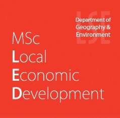
London School of Economics and Political Science

Regional Science research at the LSE is conducted in a wide range of academic departments, research institutes and centres. Its main homes are in the Department of Geography and Environment and in the Spatial Economics Research Centre (SERC). Research in Regional Science within both the Department and SERC has been concerned with issues of regional development, spatial inequality, innovation, agglomeration, labour market outcomes, urban economics, as well asproperty markets and real estate economics.
There are around 20 faculty members involved in Regional Science research. They are at the centre of a larger group involving postgraduate researchers and PhD students. The research conducted at the LSE regularly appears in top international Regional Science, Economics, and Geography journals and its quality – as well as the standing of LSE researchers – has been recognized by numerous international awards and prizes.
Much of the research developed in Regional Science at the LSE has important policy implications. This is reflected in the key roles played by LSE researchers as advisers and consultants to numerous international organisations and government departments and the private sector.
Programs and Degrees in Regional Science
Undergraduate Programme |
Graduate Programmes |
PhD Programme |
|
 |
 |
 |
|
| BSc Geography with Economics | MSc in Local Economic Development | MSc in Real Estate Economics and Finance | PhD in Economic Geography |
Thesis on Regional Science in the last five years
2012
Ivan PALAVICINI CORONA - Ph.D. - Local economic development in Mexico: the contribution of the bottom-up approach
Andrés Rodríguez-Pose
Wai San WAN - Ph.D. - Global and regional sourcing of ICT-enabled business services: upgrading of China, Hong Kong and Singapore along the global value chain
Ian Gordon
2011
Sylvia TIJMSTRA - Ph.D. - Spaces of regionalism and the rescaling of government: A theoretical framework with British cases
Andrés Rodríguez-Pose
Neil LEE - Ph.D. - Innovation, diversity and inequality. Papers in economic geography
Andrés Rodríguez-Pose
2010
Nicolas DI BOSCIO - Ph.D. - Mining enterprises and regional economic development - an exploratory analysis of the SD model
Andrés Rodríguez-Pose
2009
Thomas FAROLE - Ph.D. - Community, Society and Adaptation: Assessing the Institutional Factors Behind Long--run Growth in the Regional Economy.
Andrés Rodríguez-Pose and Michael Storper
Achilleas TSAMIS - Ph.D. - Science and Technology Parks in the Less Favoured Regions of Europe: An Evaluation of their Performance and the Parameters of Success.
Andrés Rodríguez-Pose
Ioannis KAPLANIS - Ph.D. - Spatial Patterns of Employment Polarisation and Local Capital Spillover Effects in Britain
Steve Gibbons
Awards in Regional Science in the last ten years
|
EIB-ERSA Prize - 2009 – Paul Cheshire |
||||
|
Walter Isard Award for Scholarly Achievement - 2011 – J. Vernon Henderson |
||||
|
RSAI Fellows - 2004 – J. Vernon Henderson |
||||
|
Geoffrey J.D. Hewings Award - 2009 – Henry Overman |
||||
|
AUGUST LÖSCH Prize - 2006 – Henry Overman - joint with Gilles Duranton, for their work in the field of Regional Science, particularly on creation of clusters, i.e. on spatial location of industries. |
||||
|
2009 - Guilherme Mendes Resende (2nd prize) - Multiple dimensions of regional economic growth: the Brazilian case 1991-2000 2008 - Carlo Menon (1st prize) - The Bright Side of Gerrymandering: an Enquiry on the Determinants of Industrial Agglomeration in the United States 2007 - Roberto Picchizzolu (1st prize) - Entrepreneurial Risk and the Geographical Concentration of Industries: Evidence from the UK Manufacturing Sector 1997 - Stefano Magrini (1st prize) - On the Effect of European Integration on Economic Growth and Regional Disparities |
Regional Science Scholars’
|
Andrés Rodríguez-Pose |
Vassilis Monastiriotis |
Christian Hilber |
Simona Iammarino |
Thomas Kemeny |
Eduardo Ibarra-Olivo |
Elisabetta Pietrostefani |


REPEC Ranking
The LSE is widely regarded as one of the top institutions in a number of fields related to Regional Science. It is currently ranked 1st in REPEC in the fields of Economic Geography, Microeconomic European Issues, 2nd – behind the European Central Bank –in European Economics and in Urban and Real Estate Economics, and is among the top 10 institutions in the world in Development, Innovation, and Knowledge Economy.
Vernon Henderson and Andrés Rodríguez-Pose are ranked by REPEC in the top 5% of Economics authors of the world. They all feature, according to the same ranking, among the top 15 economic geographers. Furthermore Vernon Henderson is also among the top 15 researchers in urban and real estate economics and Andrés Rodríguez-Pose in microeconomic European issues.
Programme Complet | 50ème colloque de l’Association des sciences régionales de langue française
L’équipe d’organisation du prochain colloque de notre association (50ème colloque de l’Association des sciences régionales de langue française : www.asrdlf2013.org) qui se tiendra du 8 au 11 juillet 2012 à Mons (Belgique) ont le plaisir de nous annoncer que le programme complet de la manifestation est maintenant en ligne à l’adresse suivante : http://www.asrdlf2013.org/IMG/pdf/Programme_ASRDLF_2013-3.pdf
Vous trouverez également le programme en attaché et quelques informations pratiques (itinéraire) en allant à la rubrique "Infos pratiques " http://www.asrdlf2013.org/spip.php?rubrique7
J’en profite pour vous indiquer que vous obtiendrez les horaires de train pour vous rendre à Mons (notamment depuis Bruxelles) en allant sur le site de la SNCB en suivant le lien : http://www.belgianrail.be/jp/sncb-horaires/query.exe/fn
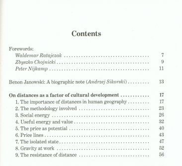
"On distances as a factor of cultural development", by Dr. Benon Janowski
We would like to inform the international audience that the All-Polish Spatial Economy Society has republished, after a 100 years’ break, an outstanding scientific paper by a Polish scholar, Dr. Benon Janowski, entitled On distances as a factor of cultural development. A socio-natural study. It employs gravity and potential theory to analyse the economic and socio-economic theory of prices. The first edition was published in Polish in 1908 in Lvov, at that time under Austrian rule.
The present hard-cover edition is available for 10€.
Contact Person: Michal Dziecielski, e-mail: This email address is being protected from spambots. You need JavaScript enabled to view it.This email address is being protected from spambots. You need JavaScript enabled to view it.
Bank account:
KOD BIC KRDBPLPW
Pl 32 1500 1054 1210 5009 1751 0000
Stowarzyszenie Gospodarka Przestrzenna
Dziegielowa 27
61-680 Poznan
Books - 2013
Knowledge Commercialization and Valorization in Regional Economic Development
The commercialization of academic knowledge is increasingly seen as a potential economic development model, particularly for improving the capabilities and economic performance of regions. This insightful volume investigates the emerging factors in knowledge commercialization from an international perspective and highlights research agendas and challenges to be met across academia, industry and government.
Regional Competitiveness and Smart Specialization in Europe
Place-based Development in International Economic Networks
Regions economically differ from each other – they compete in different products and geographical spaces, exhibit different strengths and weaknesses, and provide different possibilities for growth and development. What fosters growth in one region may hamper it in another. This highly original book presents an accessible methodology for identifying competitors and their particular circumstances in Europe, discusses regional competitiveness from a conceptual perspective and explores both past and future regional development policies in Europe.
Social Capital and Rural Development in the Knowledge Society
Edited by Hans Westlund and Kiyoshi Kobayashi
Social capital is often considered a key factor for local development. This book analyzes the role of social capital for rural areas’ survival and development in the current age of metropolitan growth – an era in which urban is the norm and where rural areas must adapt to this new situation and build innovative urban-rural relations.
The Geography of the Internet
Cities, Regions and Internet Infrastructure in Europe
Author: Emmanouil Tranos
This timely book presents a wide range of quantitative methods, including complex network analysis and econometric modelling, to illustrate how the Internet both follows, and at the same time challenges, more traditional geographies.
Regional Problems and Policies in Latin America
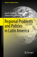
Editors: Cuadrado-Roura, Juan R., Aroca, Patricio (Eds.)
This contributed volume is the first book in English to offer a current and critical vision of regional problems and policies in the countries of Latin America. The book is in three main parts: a general overview of regional processes and trends in Latin America as a whole; country-level coverage of seven individual countries; and comparative analyses of common major problems such as migration, education, labor, poverty, decentralization, exports and foreign direct investments. Written by renowned academics and experts from the region, the book seeks to provide a better understanding of regional challenges and trends, regional disparities that exist in many Latin American countries and the increasing importance of metropolitan areas.
Metropolitan Regions
Knowledge Infrastructures of the Global Economy
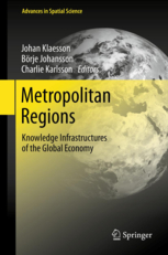
Editors: Klaesson, Johan, Johansson, Borje, Karlsson, Charlie (Eds.)
Metropolitan growth has been dramatic in the past several decades, and today metropolitan regions are recognized as the main driving forces in national growth and development as well as in national and global innovation processes. The purpose of this book is to contribute to a better understanding of how metropolitan regions and their subsystems interact and compete, why they differ in their capacity to nurture innovation and growth, and how metropolitan policies must be designed to secure the region’s long-term vitality. To that end, it presents new contributions on theories of urban growth, institutions and policies of urban change, and case studies of urban growth prepared by international experts.
Geography, Institutions and Regional Economic Performance
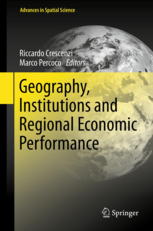
Editors: Crescenzi, Riccardo, Percoco, Marco (Eds.)
The book aims to present “traditional features” of regional science (as geographical concepts and institutions), as well as relatively new topics such as innovation and agglomeration economies. In particular it demonstrates that, contrary to what has been argued by recent economics literature, both geography and institutions (or culture) are relevant for local development. In fact, these phenomena, along with the movement of goods and workers, are among the main reasons for persisting development differentials. These intriguing relationships are at the heart of the analysis presented in this book and form the conceptual basis for a promising institutional approach to economic geography.
About Us
The Regional Science Association International (RSAI), founded in 1954, is an international community of scholars interested in the regional impacts of national or global processes of economic and social change.