RSPP Special Issue Award
Elisabete Martins
Save the Date! 2020 RSAI World Conference
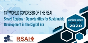
The 2020 RSAI World Conference will be held from 2 to 5 June, 2020, in Marrakech, Morocco. It will be organized by the Moroccan Section of the Regional Science Association International. The meeting is open for the world-wide regional science community and aims to bring together the key elements of multidisciplinary regional science research and to provide a scientific platform for presenting and discussing research at the frontiers of the spatial sciences in a broad sense. The themes addressed zoom in particular on the pressing challenges of meeting the 2030 Agenda of Sustainable Development Goals, in both developed and developing economies, and cover spatial dimensions ranging from local to global development. Such challenges relate to both people and places, and call for innovative and critical contributions from a conceptual-theoretical, statistical-modelling, practical evidence-based, or governance perspective.
Consequently, topics such as urban-rural development, migration, spatial and resources (al)location, border effects, urbanization, sustainable and circular cities, mobility, land use, environmental quality, disaster management, energy transition, culture, poverty, segregation, spatial justice, social justice, gender, social enterprises, policy and governance, entrepreneurship, spatial statistics and modelling are important ingredients of the 2020 World Congress. A new challenge to regional science research is formed by the emerging digital technology and its implications for analysis, monitoring, evaluation and forecasting spatial dynamics at all levels. Therefore, the potential of spatial and temporal big data, of social media information, and of the new spatial maps emerging from digitization and robotization will be addressed as well, as these forces will have far-reaching impacts on human behaviour and interaction in space.
The Mediterranean area and Africa are challenging realities on their own, and Morocco, named the most attractive investment destination in Africa according to the Africa Investment Index 2018, is the ideal venue for a conference that focuses upon the friction zones between developed and developing worlds in the Americas, in Eurafrica and in Asia. The Ocher City Marrakech provides the perfect setting of a geographically varied and pristine landscape, well connected by air, suitable to accommodate, in high quality and modestly priced hotels, many scientists from all countries, and from where they can enjoy the images of the desert, the wisdom of the Mediterranean, and the challenges and opportunities of global routes and networks. Its historical setting and geographical location at the foot of the High Atlas M ountains and at less than one hundred miles either from the Sahara dunes or from the Atlantic beaches, is a guarantee for a creative and enjoyable regional science gathering.
Contact details for more information: This email address is being protected from spambots. You need JavaScript enabled to view it.
Main organizing institutions: Regional Science Association International and its Moroccan Section AMSR in collaboration with various public and private institutions
Past Conferences
14th World Congress of RSAI
8-11 April, 2024 - Kecskemét, Hungary Proceedings
ISBN: 978-989-54216-2-6
Pages: 614
DOWNLOAD (9,9 MB)
|
13th World Congress of RSAIMay 25-28, 2021 - Virtual
Proceedings
ISBN: 978-989-54216-1-9
Pages: 1373
DOWNLOAD (62,8 MB)
|
12th World Congress of RSAI
May 29 - June 01, 2018 - Goa, India
Proceedings
ISBN: 978-989-54216-0-2
Pages: 1898
DOWNLOAD (49,41MB)
|
11th World Congress of RSAI
April 25-28, 2016 - Istanbul, Turkey |
10th World Congress of RSAI
http://www.2014worldcongress.regionalscience.org/ SOCIOECONOMIC INTEGRATION AND TRANSFORMATION: RESHAPING LOCAL, REGIONAL, AND GLOBAL SPACES May 26-30, 2014 - Bangkok, Thailand |
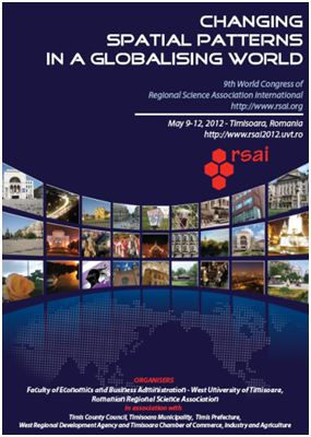
9th World Congress of RSAI
CHANGING SPATIAL PATTERNS IN A GLOBALISING WORLD May 9-12, 2012 - Timisoara, Romania |
8th World Congress of RSAIwww.aber.fea.usp.br/rsai2008
WORLD INTEGRATION, EMERGING COUNTRIES, LAGGING REGIONS AND SUSTAINABILITY
March 17-19, 2008 – S. Paulo, Brazil
7th World Congress of RSAIwww.petech.ac.za/rsai
REGIONAL SCIENCE: FROM A MICRO AND A MACRO PERSPECTIVE
April 14-17, 2004 – Port Elizabeth, South Africa
6th World Congress of RSAIhttp://www.lu.unisi.ch/wc2000-RSAI
REGIONAL SCIENCE IN A SMALL WORLD
May 16-20, 2000 – Lugano, Ticino, Switzerland
5th World Congress of RSAIMay 2-6, 1996 - Rissho University, Tokyo, Japan 4th World Congress of RSAIMay 26-29, 1992 - Palma de Mallorca, Spain 3rd World Congress of RSAIApril 2-7, 1989 – Jerusalem, Israeli 2nd World Congress of RSAIJune 4-15, 1984 – Erasmus University, Rotterdam, Holland 1st World Congress of RSAIJune 14-15, 1980 – Harvard University, Cambridge, USA
|

 http://www.2016worldcongress.regionalscience.org/
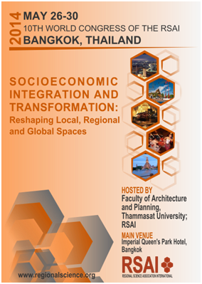
Lecturer/Senior Lecturer at NIDEA, University of Waikato
Lecturer/Senior Lecturer National Institute of Demographic and Economic Analysis (NIDEA) Faculty of Arts and Social Sciences
The National Institute of Demographic and Economic Analysis (NIDEA) is the only social sciences research institute in a New Zealand university focussed specifically on demography, population economics, population health and population geography. NIDEA has a multidisciplinary team of researchers who are well known nationally and internationally for their research excellence.
Applications are invited for a continuing position focusing on population studies and demography. Candidates whose research aligns with or extends NIDEA’s current expertise in demography, Māori and indigenous population research, population health and migration are encouraged to apply.
Applicants should have a doctoral degree in a relevant social science discipline (e.g. demography, sociology, population health, geography) and have teaching experience and a research profile commensurate with the position applied for.
Current salary range for Lecturers is NZ$74,034 to $89,163 and Senior Lecturers $91,710 to $106,995 per year dependent on qualifications and experience. Note - the rank of Lecturer in the New Zealand university system is equivalent to the rank of Assistant Professor in the North American and some other systems.
Enquiries of an academic nature should be directed to Professor Francis Collins, Director of NIDEA, email: This email address is being protected from spambots. You need JavaScript enabled to view it..
Closing date: 15 November 2018 (NZ time) Vacancy number: 380417
For more information and to apply, visit www.jobs.waikato.ac.nz
Conference in Zhaoqing China with the TRSA
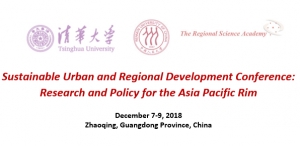
Sustainable Urban and Regional Development Conference: Research and Policy for the Asia Pacific Rim
December 7-9, 2018
Zhaoqing, Guangdong Province, China
This international conference is hosted by the Governments of Zhaoqing, China, Guangzhou Province, Tsinghua University, Renmin University of China, and The Regional Science Academy (TRSA). Zhaoqing, the host of the conference, is a city located in the Pearl River Delta about 40 miles upstream from Guangzhou, the capital of Guangdong Province. The Pearl River Delta has nearly 100 million residents and is one of the top three economically productive regions in China. It offers the right environment for an international gathering on sustainable spatial development. We are seeking participants who would like to present a paper at the Conference.
This is the second conference hosted by this group, with the first conference held at and hosted by Renmin University of China in Beijing in 2017. Some 150 papers were presented at the first conference and a selection of these contributions formed the contents for a special edition in one of the top regional science journals. At the forthcoming conference in December 2018, authors from several Pacific Rim Countries including from North and South America and Europe as well, and of course, from China and nearby countries will attend and present papers centering on the above theme. We expect about 200+ attendees this year.
Those wishing to present a paper should contact: Roger R. Stough, Vice President TRSA, Peter Nijkamp, Vice President TRSA, or Karima Kourtit, Executive Director TRSA, at one of the following email addresses.
Roger R. Stough This email address is being protected from spambots. You need JavaScript enabled to view it.
Peter Nijkamp This email address is being protected from spambots. You need JavaScript enabled to view it.
Karima Kourtit This email address is being protected from spambots. You need JavaScript enabled to view it.
Assistant Professor Position – Urban Inequality & Health Disparities – Department of Geography
Assistant Professor Position – Urban Inequality & Health Disparities – Department of Geography
The Department of Geography at the University of California, Santa Barbara invites applications for a tenured or tenure-track faculty position at the level of Assistant Professor with an anticipated start date of July 1, 2019. The Department is looking for exceptional individuals with particular emphasis in the area of urban inequality and health disparities. Urban social inequalities are observed at the individual, relationship/network, community/neighborhood, and societal levels, and are embedded in life course dynamics. The successful candidate will have research and teaching expertise on the social and structural determinants and/or observable manifestations of urban inequality at any of these levels. Topics could include, but are not limited to, disparities in health, income, transportation, or residence relating to race/ethnicity, socio-economic status, gender, or other characteristics. We are particularly interested in researchers using innovative theory and quantitative methods that account for social and spatial context. Applicants with perspectives from public health, demography, sociology, or other related fields in addition to geography are encouraged to apply. The University is especially interested in candidates who can contribute to the diversity and excellence of the academic community through research, teaching and service as appropriate to the position. Applications received by December 1, 2018 will be given priority consideration, but the position will remain open until filled. To apply please visit https://recruit.ap.ucsb.edu/apply/JPF01334.
The University of California is an Equal Opportunity/Affirmative Action Employer. All qualified applicants will receive consideration for employment without regard to race, color, religion, sex, sexual orientation, gender identity, national origin, disability status, protected veteran status, or any other characteristic protected by law.
ERSA LYON 2019 | Call for Special Session proposals

Call for Special Session proposals
The Call for Special Session proposals is now OPEN!
The Local Organising Committee cordially invites proposals for Special Sessions.
Special Sessions must be related to the congress theme or especially hot topics within the congress scope.
The Congress has also the ambition to have a stronger interdisciplinary dimension featuring contributions from social sciences, engineering and big data.
We ask you to take note of the procedure and guidelines regarding Special Sessions at ERSA 2019:
Procedure and Guidelines
What do we offer?
Special Sessions are a label of quality in the ERSA congress and we accommodate for this in several ways:
- We aim to allow 30 minutes for each presentation slot in a Special Session
- Each presentation in a Special Session will be assigned a discussant
- Each Special Session has a minimum of 4 registered presenters
- Presenters can apply for a special session on the basis of a (draft) Paper or an extended abstract (deadline February 28th 2019)
- Accepted Presentations are based on a (draft) paper that has been uploaded on the ERSA 2019 submission website before June 10th 2019
If a Special Session does not meet the conditions, the presentations will still be included in the programme, labelled as an O-session.
- You are requested to submit your Special Session Proposal using the following online submission form.
- Note, that in addition to contact information of the primary convenor, names of any co-convenors, the title, and description of the Special Session, we also ask you to list three interested presenters in your submission form.
We look forward to receiving your proposals for Special Sessions. Should you have any questions, please contact us at This email address is being protected from spambots. You need JavaScript enabled to view it.
Book: Microeconomic Modeling in Urban Science
Microeconomic Modeling in Urban Science
1st Edition
Write a review
Author: Francisco J Martínez Concha
eBook ISBN: 9780128152973
Paperback ISBN: 9780128152966
Imprint: Academic Press
Published Date: 12th July 2018
Page Count: 294
Description
Microeconomic Modeling in Urban Science proposes an interdisciplinary framework for the analysis of urban systems. It portrays agents as rational beings modeled under the framework of random utility behavior and interacting in a complex market of location auctions, location externalities, agglomeration economies, transport accessibility attributes, and planning regulations and incentives. Francisco Javier Martinez Concha considers the optimal planning of cities as he explores interactions between citizens and between citizens and firms, the mesoscopic agglomeration of firms and the segregation of agents’ socioeconomic clusters, and the emergence of city-level scale laws. Its unified model of city life is relevant to micro-, meso- and macro-scale interactions.
Key Features
- Presents a unified, coherent and realistic framework able to simulate complete urban systems
- Describes the use of discrete–choice and stochastic behavior models in the auction spatial-equilibrium market
- Includes computing outputs from Cube-Land modeling using GIS
Readership
Graduate and PhD students and early career researchers involved in modeling urban systems, primarily in urban and regional economics, transportation economics, economic geography, spatial network analysis, urban and regional planning, and environmental economics
Table of Contents
- Introduction
2. Accessibility
3. Theory of a discrete urban land market
4. A stochastic model of urban systems
5. Equilibrium analysis
6. Dynamic of urban land use
7. Applications and policy analysis
8. City scale laws
Details
- No. of pages:
- 294
- Language:
- English
- Copyright
- © Academic Press
- Published:
- 12th July 2018
- Imprint:
- Academic Press
- eBook ISBN:
- 9780128152973
- Paperback ISBN:
- 9780128152966 2018
About the Author
Francisco Javier Martínez Concha
Francisco Javier Martínez Concha is Professor at the University of Chile. His research areas encompass land use theory and modeling, and methods of evaluation of urban management policies (including regulations and subsidies). He is the creator of the Land Model of Santiago (MUSSA) and directs the professional team that develops the computational package CUBE-LAND. He is the editor of three books, author of nine book chapters, and has published 25 ISI-indexed papers.
Affiliations and Expertise
Professor in the Civil Engineering Department in the Faculty of Mathematical and Physical Sciences at the University of Chile, where he is the Dean of Faculty (2018-2022). He is Senior Researcher at the Institute for Complex Systems in Chile (ISCI).
The book is available in several online dealers, including the Publisher’s web at:
https://www.elsevier.com/books/microeconomic-modeling-in-urban-science/concha/978-0-12-815296-6
Brexit! The urban and regional implications workshop

Brexit! The urban and regional implications workshop
Organised by the Cities Research Centre, School of Geography and Planning, Cardiff University
Co-sponsored by the Economic Geography Research Group
29th March, 2019
10am - 5pm
School of Geography and Planning, Cardiff University
There is widespread belief that Brexit will have substantial economic consequences for regions and cities, but that the impacts and any subsequent economic recovery will vary across the UK. This workshop brings together various academics, and the public and private sectors, to discuss potential urban and regional impacts across the UK, and possible urban and regional strategies for mediating the economic consequences of Brexit.
Speakers include:
Professor Philip McCann (Sheffield University Management School, University of Sheffield) Professor Anne Green (City REDI, University of Birmingham) Cllr Huw Thomas (Leader, Cardiff City Council) Dr Rachel Minto (Wales Governance Centre, Cardiff University) Ben Cottam (Federation of Small Businesses) Professor Gill Bristow (School of Geography and Planning, Cardiff University)
This is a free event but places are limited.
Please book a place through Eventbrite:
https://www.eventbrite.co.uk/e/brexit-the-urban-and-regional-implications-tickets-51249219796
Open Call for a Post-Doctoral Researcher
The candidate must hold a PhD in economics, geography, urban studies or similar fields with a very strong quantitative focus. For full details see the job advert attached. Applicants should send the required documents to me (This email address is being protected from spambots. You need JavaScript enabled to view it.) with the reference “UECE/02/SAICT/2017-TiTuSS/PD/applicant surname”. More details available here: https://goo.gl/in9i6P.
Required documents:
- · Motivation letter, CV, copy of PhD award certificate, copy of passport, 3 most relevant publications with brief justification, two letters of reference.
- · The closing date for applications is 25/11/2018.
Conference "Rethinking regional competitiveness", November 28, 2018, Siauliai, Lithuania
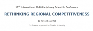
Dear colleagues,
We are delighted to invite you to participate in the 18th International Scientific Conference „RETHINKING REGIONAL COMPETITIVENESS”, which will be held on 29th November 2018 in Siauliai, Lithuania.
The special topic of the plenary session – Challenges of International Trade and Economic Potential of the Regions.
Registration deadline – November 6, 2018. www.su.lt/rethinking-regional (see Registration on the menu)
Conference fee - 30 EUR.
We kindly ask you to forward this information to the colleagues who might be interested in the conference.
Please find more information in the attached invitation.
Best regards,
Conference Organizers
About Us
The Regional Science Association International (RSAI), founded in 1954, is an international community of scholars interested in the regional impacts of national or global processes of economic and social change.