Archives
Elisabete Martins
5th EUROPEAN CONGRESS OF LOCAL GOVERNMENTS. 8th-9th April, Cracow
Multilateral and direct cooperation between European regions and cities has in recent years developed in social and economic fields till the point at which it significantly affects not only politics and the economies of individual countries but also of the entire continent.
In these difficult times cities and regions are refuge of Europe which needs unity and solidarity.
The 5th European Congress of Local Governments is a meeting platform for local leaders and regional elites to exchange views with public administration, NGOs and business.
The diversified programme will consist of 5 thematic tracks, with more than 60 events: thematic blocks, panel discussions, workshops, lectures, presentations and receptions.
See more at: http://www.forum-ekonomiczne.pl/v-europejski-kongres-samorzadow-2/?lang=en
New issue (number 42) of Investigaciones Regionales - Journal of Regional Research
Dear colleague:
We have just published a new issue of the journal Investigaciones Regionales - Journal of Regional Research (Special Issue Nº 42). It is now available both on line and print version.
About Investigaciones Regionales – Journal of Regional Research:
The founding aim of Investigaciones Regionales–Journal of Regional Research was to create a prestigious journal through which to disseminate quality research carried out in the broad academic and professional field of regional, urban and territorial studies. The review process of the papers submitted to the Journal follows international standards.
Investigaciones Regionales-Journal of Regional Research is ranked as Q2 by Scimago JRC (Scopus), in Economics, Econometrics and Finance, and indexed in other scientific and academic international databases (Emerging Source Citation Index (ESCI), EBSCO, ProQuest, EconLit, RePec, DOAJ, Redalyc, Latindex, Fuente Académica,…).
The Journal has a multidisciplinary approach, welcoming submissions from fields such as Economics, Geography, Sociology, Land Planning and Political Science, whose scientific focus, originality and added value contribute to the dissemination of new ideas and methodological approaches, strengthening and improving the quality of the publication, via its link
The contents of this issue are:
Introduction:
· Special Issue on Tourism Competitiveness in the Digital Economy
Articles:
· The challenge of long-term tourism competitiveness in the age of innovation: Spain as a case study - Luis Moreno-Izquierdo, Ana Ramón-Rodríguez, María Jesús Such-Devesa
· Venice: the problem of overtourism and the impact of cruises - Ana Trancoso González
· Public support for entrepreneurship, human capital and talent in the context of Spanish tourism - Saúl Cobo-Soler, Andrés Fernández-Alcantud, José María López-Morales, Marta Santamaría-García
· Tourism accessibility competitiveness. A regional approach for Latin American countries - Natalia Porto, Ana Clara Rucci, Matias Ciaschi
· Hotel online pricing policy: A review and a regional case study - Manuela Pulina, Valentina Santoni
· Exploring the use of artificial intelligence in price maximisation in the tourism sector: its application in the case of Airbnb in the Valencian Community - Luis Moreno-Izquierdo, Galina Egorova, Alexandre Peretó-Rovira, Adrián Más-Ferrando
· Smart tourism experiences: conceptualisation, key dimensions and research agenda - Francisco Femenia-Serra, Barbara Neuhofer
· Smart sustainability: a new perspective in the sustainable tourism debate - José Francisco Perles Ribes, Josep Ivars Baidal
· From smart destinations to smart tourism regions - Ulrike Gretzel
· Foundations and relevance of delimiting local tourism destinations - Yurena Rodríguez Rodríguez, Raúl Hernández Martín
To contact Us and Submit Manuscripts:
Investigaciones Regionales – Journal of Regional Research
Email: This email address is being protected from spambots. You need JavaScript enabled to view it.
The article will be sent through the portal Open Journal System (OJS) of the Spanish Repository of Science and Technology (RECYT): https://recyt.fecyt.es/index.php/IR/login .
Yours sincerely,
Investigaciones Regionales – Journal of Regional Research
The latest issue of Papers in Regional Science is available! Volume 98, 1 (February 2019)
 |
Papers in Regional ScienceVolume 98, Issue 1Pages: 1-598February 2019 |
ISSUE INFORMATION
FULL ARTICLES
The effect of ICT adoption on labour demand: A cross‐region comparison
Pages: 3-16 | First Published: 03 October 2017
Ethnic minority concentration: A source of productivity growth for Italian provinces?
Pages: 17-34 | First Published: 11 October 2017
The role of social capital in regional innovation systems: Creative social capital and its institutionalization process
Pages: 35-51 | First Published: 27 October 2017
The geography of social capital and innovation in the European Union
Pages: 53-73 | First Published: 19 December 2017
Human capital and market size
Pages: 75-92 | First Published: 17 December 2017
Knowledge externalities and firm heterogeneity: Effects on high and low growth firms
Pages: 93-114 | First Published: 15 December 2017
Territorial cohesion under pressure? Welfare policy and planning responses in Austrian and Swedish Peripheries
Pages: 115-132 | First Published: 22 December 2017
Impact of macro‐structural reforms on the productivity growth of regions: Distance to the frontier matters
Pages: 133-166 | First Published: 11 January 2018
Implementation of European Cohesion Policy at the sub‐national level: Evidence from beneficiary data in Eastern Germany
Pages: 167-189 | First Published: 09 January 2018
KIBS as both innovators and knowledge intermediaries in the innovation process: Intermediation as a contingent role
Pages: 191-209 | First Published: 30 January 2018
Historical and current spatial differences in female labour force participation: Evidence from Germany
Pages: 211-239 | First Published: 13 February 2018
Disparities in exploitative and exploratory patenting performance across regions: Focusing on the roles of agglomeration externalities
Pages: 241-263 | First Published: 24 March 2018
EU regional development policy and territorial capital: A systemic approach
Pages: 265-281 | First Published: 17 April 2018
A spatial decomposition of the shift‐share components of labour productivity inequality in Italy
Pages: 283-306 | First Published: 19 April 2018
By diversion rate alone: The inconsistency and inequity of waste management evaluation in a single‐indicator system
Pages: 307-329 | First Published: 28 February 2018
An interpretation of the changes in demographic behaviour at a sub‐national level using spatial measures in post‐socialist countries: A case study of the Czech Republic and Slovakia
Pages: 331-351 | First Published: 03 October 2017
Two countries, sixteen cities, five thousand kilometres: How many housing markets?
Pages: 353-370 | First Published: 24 January 2018
Spatial interactions in property tax policies among Italian municipalities
Pages: 371-391 | First Published: 20 December 2017
A spatial panel data analysis of China's urban land expansion, 2004–2014
Pages: 393-407 | First Published: 22 December 2017
Agglomeration of creative industries: An intra‐metropolitan analysis for Barcelona
Pages: 409-431 | First Published: 07 November 2017
Is there a relationship between TELs and default? Evidence from US municipalities
Pages: 433-450 | First Published: 06 December 2017
Area‐specific subsidies and population dynamics: Evidence from the Australian zone tax offset
Pages: 451-476 | First Published: 29 November 2017
Does climate matter? An empirical study of interregional migration in China
Pages: 477-496 | First Published: 19 December 2017
The interconnections between socio‐spatial factors and labour market integration among Arabs in Israel
Pages: 497-514 | First Published: 17 November 2017
Accessibility at the household level using the Structural Accessibility Layer: A forecast of potential future travel behaviour based on self‐selection of residential location
Pages: 515-538 | First Published: 05 October 2017
Overlapping labour market areas based on link communities
Pages: 539-553 | First Published: 11 October 2017
Migration and occupational careers: The static and dynamic urban wage premium by education and city size
Pages: 555-574 | First Published: 06 November 2017
The role of government in regentrification
Pages: 575-594 | First Published: 26 April 2018
BOOK REVIEWS
Regional upgrading in Southern Europe: Spatial disparities and human capital Edited by Madalena Fonseca, Ugo Fratesi. Cham, Switzerland: Springer, 2017. 358 pp. ISBN 978–3–319‐49817‐1
Pages: 595-597 | First Published: 10 September 2018
A new perspective on agglomeration economies in Japan: An application of productivity analysis
Pages: 597-598 | First Published: 12 September 2018
IALE Symposium (Milano, July 2019)-Policy and Governance Innovation in Agricultural Landscapes-call closing 25th February
Dear Colleagues,
I would like to raise your attention for a symposium on the Policy and Governance Innovation in Agricultural Landscapes, at the next IALE (International Association for Landscape Ecology) World Conference in Milano (Italy), 1st-5th July 2019.
The symposium is entitled "Policy and governance innovation in agricultural landscapes: Recent trends and future pathways towards enhanced sustainability and food security". A full description can be found here: http://www.iale2019.unimib.it/wp-content/uploads/sites/23/2018/11/SYMP53.pdf
Conveners are José Munoz-Rojas and Teresa Pinto-Correia (ICAAM, Évora), Isabel Loupa-Ramos (IST-Lisbon), Rafael Mata Olmo (UAM-Madrid) and Lone Kristensen (U. Copenhagen)
A Special Issue will be published in either Sustainability (https://www.mdpi.com/journal/sustainability) or Land (https://www.mdpi.com/journal/land)
For submission of abstracts, please go to the following website and submit by the 25th February 2019: http://www.iale2019.unimib.it/abstract-submission-form/ (and select SYMP53)
For any queries, please do not hesitate to contact me or any other co-convener directly
Looking forward to receiving your contributions
3rd Call | The International Congress on Sustainable Development, Public Management and Territorial Governance (28-31 May 2019, Poland)
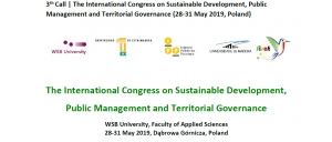
The International Congress on Sustainable Development, Public Management and Territorial Governance
WSB University, Faculty of Applied Sciences 28-31 May 2019, Dąbrowa Górnicza, Poland
The International Congress on Sustainable Development, Public Management and Territorial Governance is organized in cooperation:
- WSB University,Poland
- University of Extremadura,Spain
- Polytechnic Institute of Portalegre,Portugal
- University of Madeira,Portugal
- FISAT.
The congress will take place between 28 and 31 May 2019, at the Faculty of Applied Sciences, WSB University, in Dąbrowa Górnicza, Poland.
This event will explore the ongoing dynamic, emerging issues and future challenges regarding territorial governance and public management as well as the other fields of research that may have an influence on sustainable development.
Contextually, several themes will be addressed, namely: Public Management; Territorial Governance and Strategies; Cross-Border Cooperation and Inter-Regional Cooperation; Inter- Organizational Cooperation; Sustainable Planning; Sustainable Development; Smart Cities; Biodiversity Policies and Strategies; Accessibility and Connectivity Transport Systems; Sustainable Tourism Management; Sustainable Culture Management; Renewables Energies; Circular and Green Economy; Environmental Rights and Legislation; Migratory fluxes - Strategies, Management and Planning.
Keynote speakers:
- Elisabete A. Silva, University of Cambridge, Great Britain
- Christophe Sohn, Luxembourg Institute of Socio-Economic Research, Luxembourg
- Martin Klatt, University of Southern Denmark, Denmark
- Ana Vulevic, Institute of Transportation CIP, Serbia
- Hana Stverkova, VŠB-Technical University of Ostrava, Czech Republic
- Fernández, Jeri, António, FISAT, Peru
Working agenda:
28thMay
Opening Ceremony & Gala Dinner (starting at 7 p.m.)
29thMay
Plenary session, parallel sessions (from 9 a.m. to 5 p.m.), trip to Katowice, social dinner at 7 p.m.)
30thMay
Parallel sessions, poster session, workshop with scientific journals’ editors (from 9 a.m. to 5 p.m.), social dinner at 7 p.m.
31stMay
Closing session, trip to Cracow with Gala Lunch (ending at 5 p.m.)
Early registration should be open until February 17, 2019. However, late registration will be possible as well. The registration deadline is April 30, 2019. Registration forms should be sent to the following address www.wsb.edu.pl/congress (conferenceregistration).
Registration fees:
Early Registration – 280,00 €;
Late Registration – 350,00 €;
Student (subject to confirmation) – 200,00 €.
The payment should be made by April 30, 2019.
in euro - Akademia WSB w Dabrowie Gorniczej / WSB University in Dabrowa Gornicza
ING Bank Śląski S.A.; 40-086 KATOWICE UL.SOKOLSKA 34; Poland
IBAN / account number: PL 05 1050 1227 1000 0023 3028 9576
code BIC (SWIFT) INGBPLPW
in zloty -Akademia WSB w Dąbrowie Górniczej
IBAN / account number: 64 1050 1272 1000 0008 0063 3554
Transfer name: „Congress 2019” + the name of the participant
The participants should send the payment confirmation to the congress email address: This email address is being protected from spambots. You need JavaScript enabled to view it.
Abstracts and papers in English, Portuguese or Spanish should be submitted to the following e-mail address: This email address is being protected from spambots. You need JavaScript enabled to view it.
The submitted abstracts will be reviewed by the Congress Scientific Committee, according to the adequacy of the contents of the Congress topics. Please submit an abstract of no more than 200 words, before the 17thof February, for prior evaluation. Posters may also be submitted – the authors should use the specific format available on the congress website. The submission process will take place between November 1, 2018, and April 30, 2019. Successful applicants will be informed on a regular basis, no later than May 5, 2019. The deadline for full papers is May 24,2019.
Congress languages: preferably English, however Polish, Portuguese and Spanish can also be used (especially during parallel sessions).
The publication of the works in a Book of Abstracts (with ISBN) is foreseen as the Congress outcome.
The best works will be invited to be published - as a book chapter - by the prestigious publisher “Thomson Reuters” (7th worldwide position in scientific publications) – an additional payment of 300,00€ - the guidelines for authors could be found on the eventwebsite.
Other works will be reviewed for possible publication in Scientific Journals associated with the event:
Sustainability (ISSN 2071-1050) – special issue: Sustainable Cross-Border Cooperation: Common Planning, Policies, Strategies, Methods and Activities (Editors: Joanna Kurowska-Pysz, Rui Alexandre Castanho, Luís Loures) – publication fee according to the price list
Regional Science Policy & Practice (ISSN 1757-7802) – special issue: New trends and Dynamics on Territorial Management and Governance (Editors: Rui Alexandre Castanho, Joanna Kurowska-Pysz, Katarzyna Szczepańska-Woszczyna) – publication fee according to the price list
Forum Scientiae Oeconomia (ISSN 2300-5947), an international journal published in Poland, indexed in: EBSCO, ARIANTA, BazEkon, CEEOL, ERIH Plus, Google Scholar, Index Copernicus, PBN - Polska Bibliografia Naukowa, DOAJ (accredited by Polish Ministry of Science and Higher Education – 7 points) - no publication fees.
Revista Monfragüe Desarrollo Resiliente (ISSN 2340-5457) - the journal focuses on scientific works regarding the approach of resilience, as a more concrete approach than the traditional concept of "Sustainability". Thus, the journal provides an open space of reflection and rigorous debate, for those who intend to enter the study of the resilient development - no publicationfees.
Congress participants shall cover the publishing costs and pay fees directly to the publishers after the paper has received positive reviews.
If the proposal is accepted and the participant cannot attend the event, it is possible to send the poster – still, the registration payment is required.
Accommodation costs are not included in the congress fee. Suggested accommodation:
Holiday Inn**** Dąbrowa Górnicza https://hidabrowa.pl/en/ booking - until places are empty, 15th April at latest
please contact with the hotel using e-mail: This email address is being protected from spambots. You need JavaScript enabled to view it.in the correspondence use the contact password: WSBUniversity
the prices: 229 pln single / 279 pln double
Pogoria Residence*** Dąbrowa Górnicza http://www.pogoriaresidence.pl/en/
booking - until places are empty, 15th April at latest
please contact with the hotel using its online booking system
in the correspondence use the contact password: WSBUniversity the prices: 179 pln single / 233 pln double
Suggested airports in Poland, with the best access to the congress venue:
Katowice Airport https://www.katowice-airport.com/en/
Kraków Airport http://www.krakowairport.pl/en/
Warsaw Chopin Airport https://www.lotnisko-chopina.pl/en/index.html
Chairpersons (contact persons):
Joanna Kurowska-Pysz, Rui Alexandre Castanho, Julian Mora Aliseda
e-mail address: This email address is being protected from spambots. You need JavaScript enabled to view it.
Hope to see you in Poland.
Open position at the University of Eastern Finland, Joensuu
Professor of Human Geography (Regional Studies)
The University of Eastern Finland, UEF, is one of the largest multidisciplinary universities in Finland. We offer education in nearly one hundred major subjects, and are home to approximately 15,500 students and 2,500 members of staff. We operate in Joensuu and Kuopio. In international rankings, we are ranked among the leading universities in the world.
The Faculty of Social Sciences and Business Studies operates on two campuses of the University of Eastern Finland – in Joensuu and Kuopio. The faculty trains experts in the fields of history, geography, economics and business administration, law, social sciences,and social and health management. The faculty's research is closely linked to the research areas identified in the university's strategy. The faculty has approximately 4,300 Bachelor’s and Master’s degree students and approximately 450 postgraduate students actively pursuing their studies. The faculty has approximately 300 staff members. www.uef.fi/yhka
We are now inviting applications for
a Professor of Human Geography (Regional Studies) position, Department of Geographical and Historical Studies, Joensuu Campus
The focus of the professorship is regional studies in the context of human geography. A re-gion is defined as a broad concept that offers perspectives on, e.g., scales, territorialism, re-gional development and regional policy, as well as on border studies and health geography. In the framework of human geography, research should be based on strong social theoretical and spatial approaches; the application and development of various qualitative and quantitative methods, including geoinformatics, are central to this framework.
A description of the post has been prepared for the purposes of describing the professorship/ filling the professorship. This description of the post specifies the professor's duties, qualification requirements and appendices to be included in the application. The description of the post is available on the website at http://www.uef.fi/en/web/guest/uef/open-vacansies/instructions.
The position will be filled with an open-ended contract as from 1 August 2019.
The salary of the position is determined in accordance with the salary system of Finnish universities and is based on levels 8 - 11 of the job requirement level chart for teaching and research staff (€4,771.69 – 7,031.37/month). In addition to the job requirement component, the salary includes a personal performance component, which may be a maximum of 50 % of the job requirement component.
Further information:
Dean Sari Rissanen (+358 405943774 / This email address is being protected from spambots. You need JavaScript enabled to view it.); Head of the Department of Geographical and Historical Studies Minna Tanskanen (+358 503728884 /This email address is being protected from spambots. You need JavaScript enabled to view it.). Further information relating to the application procedure can be obtained from Executive Head of Administration Ulla Hurskainen (+358 5125238 /This email address is being protected from spambots. You need JavaScript enabled to view it.)
A probationary period is applied to all new members of the staff
The electronic application is required to contain the following appendices:
1) a resume or a curriculum vitae compiled in accordance with the template for researcher’s curriculum vitae of the Finnish Advisory Board on Research Integrity (http://www.tenk.fi/en/template-researchers-curriculum-vitae)
2) a portfolio of teaching merits (http://www.uef.fi/en/web/guest/uef/avoimet-tyopaikat/liitteet --> Faculty of Social Sciences and Business Studies -> Portfolio instructions)
3) a complete list of publications compiled in accordance with the publication classification of the Ministry of Education and Culture (https://www.aka.fi/en/funding/how-to-apply/application-guidelines/guidelines-for-list-of-publications/)
4) a plan (no more than 4 pages) of the applicant's views on how to develop the field with regard to research, education and societal interaction
5) a. a separate, numbered and indexed list of a maximum of 10 publications with which the applicant wishes to demonstrate his or her qualifications and merits for the post;
b. copies of the publications referred to in the list.
6) copies of the applicant’s academic degree certificates / diplomas
7) copies of certificates / diplomas relating to the applicant’s language proficiency, if not indicated in the academic degree certificates / diplomas.
The application needs to be submitted no later than 20.2.2019(by 24.00 hours Finnish time)by using the electronic application form.
Portuguese Review of Regional Studies (RPER): Nº 50 (2019) is already available!
It is a pleasure to inform you that the issue nº. 50 (2019) of our journal (Portuguese Review of Regional Studies) is now available online. You can accede to it using the link:
Call for Papers | 22nd Uddevalla Symposium 2019 - 27-29 June - abstract deadline 28 January 2019
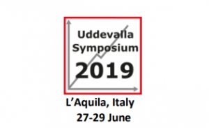
We are very happy to invite you to submit abstracts to the 22nd Uddevalla Symposium 2019, June 27-29, 2019 on:
Unlocking the Potential of Regions Through Entrepreneurship and Innovation
This year hosted by the Gran Sasso Science Institute (GSSI) (School of Advanced Studies), in L’Aquila, Italy.
Abstract Submission Deadline: January 28th, 2019
We are proud to present 11 famous Keynote Speakers that will talk about their current research on different perspectives of the overall theme:
Please see more information in attached Call for papers and at the homepage https://symposium.hv.se/call-for-papers/
Best wishes,
Iréne Bernhard, Chair
On behalf of the Organizing Committee
16th EU-REAL Workshop | September 3-4, 2019, Pescara (Abruzzo), Italy

Dear Friends,
The Department of Economic Studies of the "G. d’Annunzio" University of Chieti-Pescara, Italy, has the pleasure to host the 16th European Union Regional Economics Applications Laboratory (EU REAL) Workshop, with a focus on "New directions in regional development and spatial inequalities". The workshop will be held in Pescara (Abruzzo), in September 3-4, 2019.
We are delighted to welcome the EU-REAL community to discuss our research and to enhance the cooperation among our institutions, in the year in which REAL celebrates 30 years of Quality Research (1989-2019).
We kindly invite contribution on topics related (but not limited to):
- Regional economic growth and development
- Regional, rural and urban policy
- Infrastructure, transport flows and networks among regions
- Input-Output (I-O) and Computable General Equilibrium models (CGEs)
- Tourism and regional development
- Migration and regional labor markets
- Regional healthcare planning and migration flows
- Quantitative methods for regional sciences
- Spatial concentration
- Spatial econometrics and statistics
- Spatial inequalities
- Natural environment, resources and sustainable development
Abstracts should be sent in Doc or Pdf -format, with a maximum of 500 words, including author's name(s), affiliation(s), main topic and 3-5 keywords and be sent to
This email address is being protected from spambots. You need JavaScript enabled to view it. by May 15th, 2019.
Looking forward to seeing you in Pescara.
Best,
Alfredo Cartone, Domenica Panzera, Paolo Postiglione
Invitation of Young Researchers (PhD students) For Participation in the Nurturing Talent Workshop, Essaouira, Morocco, February 28-March 1, 2019
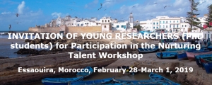
Invitation of Young Researchers (PhD students)
For Participation in the Nurturing Talent Workshop
Essaouira, Morocco, February 28-March 1, 2019
I am pleased to invite you to participate in our international Workshop on “Innovation and Creativity in Regions in the Developing World”, to be held in Essaouira (Morocco) from February 28 to March 1 2019. This workshop is part of the Nurturing Talent programme of the Regional Science Association International. The aim is to stimulate young researchers to present and discuss their work and to be connected with other promising and talented researchers in a dedicated field of regional science. We expect some 5 senior scholars from outside Morocco (Peter Nijkamp, Mark Partridge, Tomaz Dentinho, Karima Kourtit and Andrea Caragliu) and other scholars from the country to guide the two-day workshop, to act as a sounding board for your research, and to introduce you to international research networks or publication outlets.
Essaouira is one of the most beautiful coastal cities in Morocco and can easily be reached easily by ground transportation in less than two hours from the city of Marrakech (which has many international connections). We will be able to cover the local costs (accommodation, food and local transportation costs) during your stay at the workshop. So, only your international travel costs have to be covered by your home institution.
I would like to add that the workshop is organized back-to-back with an international conference on “From Creativity in the City to the Creative City” which will be held from February 26 to March 1, 2019 in the same place. You are of course also cordially invited to participate (optionally) in this international conference.
If you are interested in joining the above mentioned workshop, you are requested to send an expression of interest to my e-mail address (This email address is being protected from spambots. You need JavaScript enabled to view it.), accompanied by a title and short abstract (in english) of your planned presentation, before February 3, 2019. You will receive more information after acceptance by the committee of evaluation of your letter of interest and abstract. Notification of acceptances will be communicated by February 10th, 2019.
I am really looking forward to welcoming you in Essaouira soon.
Cordially yours,
Abdellatif Khattabi
Workshop organizer
About Us
The Regional Science Association International (RSAI), founded in 1954, is an international community of scholars interested in the regional impacts of national or global processes of economic and social change.