My first exposure to Regional Science was through my late uncle, Marcel Anselin, who was an economics and planning professor at the University of Ghent in Belgium. I was an undergraduate in economics at the Free University of Brussels (the VUB) and he and my aunt would have me over to their place in Provence during the summer. Over dinner (and wine) he would talk about his participation in the European Regional Science conferences and meeting early visionaries such as Walter Isard, Thomas Reiner and John Dyckman. I was hooked.
After my undergraduate work (1975), I completed a masters degree in Econometrics, Operations Research and Statistics at the VUB (1976) and also did some graduate work in my uncle’s regional planning program in Ghent. By then, I had a position as a research associate in the Center for Demography at the VUB run by Ron Lesthaeghe, where I worked on a model that integrated long term economic and demographic trends, coincidentally also the topic of my undergraduate thesis. At the time (1977), the prospects for an academic career in Belgium were pretty dismal, so I was encouraged by my uncle and my undergraduate mentors (including Herbert Glejser, a well-known econometrician) to pursue further graduate work in the U.S. My uncle had (nearly identical looking) flyers from the Cornell and Penn Regional Science programs. I applied and was admitted to both to study under Isard, who was affiliated with both places. It was a difficult choice, but my decision was made easy by a call from Isard to my parents’ home encouraging me to pick Cornell. As it turned out, Isard moved there full time the next year.
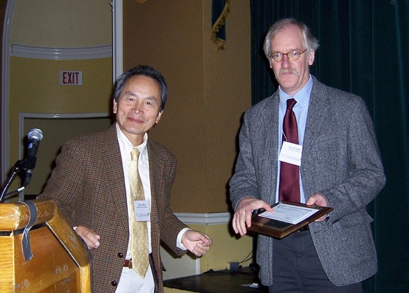
Anselin receives the Alonso prize from Koichi Mera
As part of my research in the Center for Demography, I had become interested in cross-sectional econometric analysis and in the problem of “spatial autocorrelation.” In the 1970s, economic time series tended to be short and Belgium had good data at the level of the “arrondissements” so that a cross-sectional (or pooled time-series cross-sectional) perspective was very attractive. This brought me to the early work in spatial econometrics by the Dutch regional economists Paelinck, Kuipers and Hordijk and the UK statisticians and geographers Ord, Ripley and Cliff. This is what I wanted to pursue for my dissertation. Of course, what I did not realize is that at Cornell nobody was really interested in this topic, let alone did work on it. I had a very hard time convincing Isard that this could be turned into a dissertation, as his initial reaction was to dismiss spatial dependence as a “red herring” (not knowing what this was, I had to look it up). Eventually, he agreed that I could pursue it, as long as I also worked on integrated multiregional models, which I did. I also had Bill Greene on my dissertation committee, to make sure that what I did was legitimate econometrics.
At Cornell, I did not take many courses, but had several intense independent studies with Isard and Stan Czamanski, who was also on my committee. In summer 1980, Isard organized the first World Regional Science and Peace Science Congress in Cambridge (MA) and had me attend (for two weeks!) as a rapporteur. It was a great opportunity to meet the leading and up and coming regional scientists, such as Bill Alonso (I had written a paper on his general theory of movement, which became my first publication, co-authored with Isard), Geoff Hewings, David Boyce, Peter Batey and the late Moss Madden, among others (I would later co-edit a book with Moss).
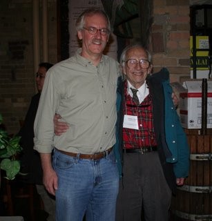
Luc Anselin with Walter Isard
In addition to being a valued advisor and a great role model, Stan Czamanski was also instrumental in helping me get my first academic position. His son, Dan Czamanski was a faculty in City and Regional Planning at Ohio State and I was encouraged to apply for a position. I joined the department in Fall of 1980. At Ohio State, there was a small informal Regional Science group with Czamanski, Larry Brown and Emilio Casetti among others, which made for a very stimulating intellectual environment. I continued to work on integrated multiregional modeling. I also continued to work on the specification of spatial interaction models, which resulted in my first NSF grant. However, very quickly, I returned to my original interest in spatial econometrics, specification tests and estimation methods.
This further intensified after my move to UC Santa Barbara in 1985, where I joined the geography department. I received my second NSF grant, this time to work specifically on spatial econometric methods. At one of the North American RSA meetings, Peter Nijkamp encouraged me to consider compiling my papers into a book for the Kluwer Series in Operational Regional Science, of which he was the editor. This became my 1988 Spatial Econometrics book. I intended it to be more than simply a compilation of my earlier work, but set out to situate spatial econometric methods within econometrics as such, with a focus on the treatment of spatial dependence and spatial heterogeneity. The book ended up being a great success and it is still available for sale. One of the challenges for the book was to come up with good empirical examples to illustrate the range of estimation methods and test statistics. This also required software. I had already started to turn the Fortran code from my dissertation into Gauss (a matrix language) and developed this into a software package for spatial econometrics, SpaceStat. First, I used it mostly in my teaching, but as the demand (via word of mouth) increased, I decided to have it distributed by the NSF-funded National Center for Geographic Information and Analysis (NCGIA) that had been established at UCSB in the late 1980s. SpaceStat turned out to be extremely popular, and I believe it may have had a lot to do with the dissemination of the spatial perspective among the mainstream social sciences. During my time at UCSB, my world perspective gradually started to shift from that of an economist to more of that of a geographer, or, more specifically, a geographic information scientist. In part, this was a result of the interaction with my colleagues Waldo Tobler and Reg Golledge, and later Michael Goodchild and Art Getis (who spent his summers in Santa Barbara), as well as through my involvement with NCGIA. At UCSB, I also had my first doctoral students: Sergio Rey and Uwe Deichmann. Serge became a lifelong collaborator and friend and is now my colleague at ASU. Uwe joined the World Bank and we have occasionally worked on studies together.
While at UCSB, I became more involved with RSAI. I was the local organizer of the 1989 Santa Barbara meetings and was appointed North American Editor (1992) and then Editor-in-Chief (1993) of the Papers in Regional Science.
Late one night at the NARSC meeting in New Orleans, Andy Isserman approached me about joining him at the Regional Research Institute (RRI) of West Virginia University. Those who knew Andy well (he sadly passed away in 2010) understand that he did not easily take no for an answer, and, after some back and forth, I agreed to the move in 1993. RRI was a fantastic environment. It occupied a small house on High Street in Morgantown, sufficiently separate from the campus to provide for a great research setting, but yet connected to faculty in several departments. The place had a fantastic library with an enviable collection of urban and regional journals. At RRI, I was able to devote almost all my time to research and started work in several new directions, in collaboration with two new PhD students, Oleg Smirnov and Attila Varga. At UCSB, I had started to work in GIS and specifically on connecting spatial analytical capability to GIS software. I pushed this further, initially still using the GIS for the visualization (the SpaceStat and ArcView link), but gradually developing a free-standing software capability, the core of what later would become GeoDa. This interest in computation matched Oleg’s dissertation work, and we jointly explored various ways to scale up spatial estimation methods to larger data set sizes. Paralleling this, I started to investigate exploratory spatial data analysis or visual analytics and various ways to make the results of spatial autocorrelation analysis graphical. This yielded the idea for the Moran scatter plot and the Local Indicators for Spatial Autocorrelation (LISA). The 1995 Geographical Analysis paper that introduced these concepts turned out to be my most cited article (approaching 5,000 citations in Google Scholar).
Attila Varga was interested in the impact of university research on the regional economy. I had done some early work on this topic at UCSB (which had got me connected with Raymond Florax, serving on his dissertation defense), and Attila had obtained a very interesting data set from Zoltan Acs (now at George Mason). This was the start of a series of joint papers dealing with the spatial impacts and spillovers of university research, which received considerable attention in the literature. During this time, I also organized several series of special sessions on spatial econometrics at the Regional Science meetings, which resulted in an edited volume with Raymond Florax.
In the mid 1990s, I was contacted by Anil Bera, an econometrician at the University of Illinois about a way to extend a test statistic he had developed into the spatial domain. This turned into the robust Lagrange Multiplier tests for spatial lag and spatial error dependence, and a much cited joint paper in Regional Science and Urban Economics (1996) with Bera, Florax and Yoon. Next, Anil and I also wrote the first overview of spatial econometrics for the Handbook of Applied Economic Statistics, which was the first of a number of such chapters that I authored in the next 10 years. These chapters went a long way to make “mainstream” econometricians engage with spatial issues.
At RRI, Andy Isserman insisted that I become involved with the International Regional Science Review, which I joined as Editor in 1996, something that I continued to do until a few months ago. Andy left RRI in 1997, but after a brief passage at UT Dallas, I rejoined him at the University of Illinois in Urbana-Champaign, where he had returned. My new home was the Department of Agricultural and Consumer Economics and I also became part of Geoff Hewings’ REAL group.
At Illinois, my interest started to shift even more to the computational aspects of spatial data analysis. I established the Spatial Analysis Laboratory and had an exciting new cohort of graduate students and visitors (e.g., Ibnu Syabri, now at Bandung Institute of Technology; Nancy Lozano, now at the World Bank; Julia Koschinsky, now at ASU; and Julie LeGallo, University of Franche-Comte). I was a Co-PI of the NSF-funded Center for Spatially Integrated Social Science (CSISS), specifically tasked with coordinating and developing software. Out of this came the first release of the GeoDa software package in 2003. The adoption of GeoDa vastly exceeded our initial expectations (a goal of 1,000 adopters listed in the NSF proposal) with over 120,000 users to date. In parallel with the development of GeoDa, I also started to collaborate with Serge Rey on PySAL, an open source library for spatial analysis, written in Python. Both projects are still very active.
Around that time, my work started to receive broad recognition in the Regional Science community: I was elected Fellow in 2004, received the Isard Award in 2005 and the Alonso Prize in 2006. In 2007, I moved to Arizona State University to lead the School of Geographical Sciences and later merged it with the planning program to found the School of Geographical Sciences and Urban Planning. I also set up the GeoDa Center as the successor of the Spatial Analysis Lab, and was able to recruit an outstanding set of colleagues, post-docs and graduate students. The GeoDa Center has become a hub for the development and dissemination of open source spatial data analysis software, including an open source and cross-platform version of GeoDa and bi-annual releases of the PySAL library. In 2008, I was elected to the U.S. National Academy of Sciences, the only person with a PhD in Regional Science in that body. In 2011, I was also elected to the American Academy of Arts and Sciences. In that year, ASU had appointed me as a Regents’ Professor, after awarding me with an endowed chair the year before. They allowed me to name the chair and I contacted Isard to obtain his permission. This turned out to be my last conversation with Walter, but I am extremely proud to be the holder of the Walter Isard Chair at ASU.
After six years as an administrator, I stepped down and enjoyed 1.5 years of sabbatical, teaching and engaging with colleagues at MIT, Brown University and the University of Chicago. I also finished a long-standing project and published Modern Spatial Econometrics in Practice, a Guide to GeoDa, GeoDaSpace and PySAL with Serge Rey. I have started a new research agenda, focusing on the integration of ideas from econometrics, statistics and machine learning into a new spatial data science, and the exploitation of new (and big) data sources to study the dynamics of cities and regions. I am still hooked.
(Published on RSAI Newsletter 2015 May)