Place and Time: The Right Place at the Right Time
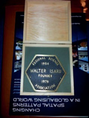
While I was an M.S. student at Penn State in 1956, I saw a booklet published by the Association of American Geographers which gave the names of dissertations written by students in U.S. and Canadian university Ph.D. programs. Just a few departments caught my attention as places where my interests might lie. Allan Rodgers, a professor at Penn State and an inspiring teacher, encouraged me to seek a challenging research environment. After spending five years at Penn State happily working on bachelor’s and master’s degrees, I decided on the University of Washington. At Washington, my fellow grad students included Brian Berry, John Nystuen, Bill Bunge, Michael Dacey, Waldo Tobler, Richard Morrill, and Duane Marble. My professors were William Garrison, Edward Ullman, Arnold Zellner, Morgan Thomas, and Marion Marts. What a group! No need to seek stimulation – it was there every day. Important questions having to do with central place theory, city growth, transportation, trade, and retail location were argued and discussed. Donald Hudson, the chair at UW, opened the xerox copier room to grad students so that they could circulate their ideas. The environment was electric. Garrison, in his gentle way, ruled over this surfeit of intellectual curiosity. The underlying theme was that geography, as a discipline, was moribund, simple-minded, and useless, and if it was to survive as an intellectually respectable field it would have to become scientific. We spouted theories, tested hypotheses, copied techniques from the quantitative economists and, in general, set out to remake the discipline. Of course, there was resistance, not only at Washington, but among the field’s leadership at such places as the Universities of Wisconsin and Syracuse. This only increased our resolve, but unfortunately, some of the main journals rejected our papers on the grounds that they were too quantitative. When the University of Chicago’s department hired Brian Berry, it was like the breakthrough that opened the door to others of the Washingtonians. Before long, Northwestern, Michigan, Michigan State, and Pennsylvania, where Walter Isard was laying the groundwork for the new field of regional science, had young Washington Ph.D.s on their faculties.
Fortunately for me, I met my wife to be, Judy Marckwardt, at Washington. As an undergrad at the University of Michigan she had asked John Nystuen, who was a faculty member at UM, where she might do graduate work. He enthusiastically described Washington to her. She specialized in cartography under the tutelage of Professor John Sherman, a well-known cartographer sympathetic to the Garrison-led school. Instead of taking an NDEA fellowship to Princeton to study historical cartography, she decided to go with me. We were married in Ann Arbor, her hometown, where her father was an exceptional scholar in the English/Germanic languages and literature. I mention this simply because our household, inspired by Al Marckwardt at Michigan, for us first at Michigan State then at Rutgers became an academic cauldron where Judy and eventually our three children spent most of their time devoted to their studies. Judy was employed by Educational Testing Service of Princeton and eventually our girls became students at the University of Illinois’ experimental school, Uni High. Hilary, my oldest child, while a high school student in Illinois, became a Presidential scholar.
While I was at Michigan State, Bill Bunge at Wayne State, Waldo Tobler and John Nystuen at Michigan, and Don Blome and I formed what we called the Michigan Inter-university Consortium for Mathematical Geography (MICMAG).
John developed a working paper series that added to and continued similar types of series established at Washington, Northwestern, Iowa, and Ohio State. In this atmosphere, deepening knowledge of Christaller, Lösch, Isard’s regional science, and the new ideas emanating from Harold McCarty’s Iowa school were discussed.
Michael Dacey managed to have influential quantitative papers published in the journals of Economic Geography and the Annals of the AAG, finally establishing quantitative geography as a mainstream sub-discipline of geography. Together with others, I taught modeling and probability theory at Northwestern University Summer Institutes. Our students were mainly faculty from around the country and world who wanted to learn of the new techniques in geography.
The revolutionary spirit felt strongly by the Washingtonians had spread to England. Peter Haggett, a Cambridge Ph.D. and a friend of Brian Berry, was hired at Bristol University, where I visited in 1966–67. He, with Richard Chorley of Cambridge, became the “terrible twins” of the new geography in Britain. Among the new geography “scientists” at Bristol were David Harvey, Michael Chisholm, Allan Frey, Barry Garner, Andrew Cliff, Roger Downs, and Barry Boots. A young Ph.D. from the London School of Economics, Keith Ord, had just arrived at Bristol in the economics department. Originally from the same town in Yorkshire as was Andy Cliff, these two got together to work on something called “spatial autocorrelation.” Although one result of their work was the creation of a new spatial autocorrelation statistic, they named it not after themselves (which I think they should have) but for the statistician who laid the groundwork for it, P.A.P. Moran. They developed the rationale for the statistic, created the formulation for its variance, recognized its nuanced difference when used for testing residuals from regression, and published all of this in a Pion monograph in 1973 to be expanded into a full volume with examples in 1981.
During these years I joined the young quantifiers testing central place theory, creating point pattern analytic routines, and trying to instill in my students a love for the analytic side of geography. Some of this work was with Barry Boots who, after Les Curry died and Yorgos Papageorgiou retired, went on to become the leading quantitative geographer in Canada. Barry and I had a book on pattern analysis published by Cambridge University Press. As a graduate committee member in those early years, I advised, among others, Boots, Kingsley Haynes, Marc Armstrong, and Peter Muller.
Judy and I realized that to finish the formal education of our children we would have to enhance my salary. We wrote a textbook (with Jerome D. Fellmann, a colleague at Illinois) called Introduction to Geography, which is now in its 13th edition. We were then able to send our daughters to the colleges they adored: Hilary to Harvard, Vicky to Oberlin, and Annie to UC Santa Barbara.
 In the 1980s, except for the influence of the new technologies used in GIS, geography began to return to its original non-scientific state. Many of the early geography quantifiers felt the decline of scientific geography and sought the stimulation emanating from the field of regional science. I spent the Spring Semester of 1970 with Walter Isard at his Regional Research Institute at Harvard. I found the meetings of the Regional Science Association exciting and stimulating. One day, after many tries at developing the variances for something that became local statistics, I got in touch with Keith Ord and asked if he might want to give it a go. At that time, in the 1980s, Keith had left England for a position at Penn State.
We developed a smooth working relationship. He was able to come up with the required proofs. I was then at the University of Illinois with Geoff Hewings and a host of other outstanding scholars. Keith and I developed something called the Getis-Ord G statistics which we published in Geographical Analysis. Soon after, Luc Anselin, took the global statistics, Moran’s I and Geary’s c, and created a family of local spatial autocorrelation statistics called LISA (Local Indicators of Spatial Association). These events, the creation of G statistics and LISA, triggered new research on the local characteristics of a myriad of georeferenced variables. But, perhaps most significantly, these statistics became an arm of spatial modeling, pattern analysis, and the all-important tests needed for residuals from regressions of various kinds. They have given rise to cluster determination, spatial filtering, and tests on many aspects of spatial autoregressive models.
In the mid-1980s, I took a sabbatical from Illinois to UC Santa Barbara, mainly to interact with Waldo Tobler. Fortunately for me, Luc Anselin had recently arrived in the geography department there from Ohio State’s urban planning department. Luc’s work with spatial autocorrelation further stimulated me. Luc was finishing for publication his book Spatial Econometrics: Methods and Models. I had a chance to review it. The book easily can be used as a text on spatial modeling. It has gone on to become the most heavily cited book in the field of spatial econometrics, and it motivated me to consider the structure of spatial weights matrices and a host of other spatial concepts.
Unknown to me in the late 1980s was that San Diego State University had applied for a Ph.D. program in geography that would emphasize the scientific aspects of the field. Rules of separation between the University of California (UC) and the California State Universities (SDSU is a member of CSU), required SDSU to seek a cooperating program in the UC system. Ernst Griffin, chair at SDSU, asked UCSB to be their partner in the development of a joint Ph.D. program. David Simonett at UCSB agreed. I left Illinois to take on the directorship of that program. It seems that my association with both UCSB and a one semester visiting professorship at SDSU helped make the spatial transition relatively easy. Not long after, in the early nineties, I moved into the Stephen and Mary Birch Endowed Chair of Geographical Studies at SDSU, and Douglas Stow took over the directorship of the program. It was at that time, in the early 1990s, that the Getis-Ord statistic was published in Geographical Analysis. In the meantime, I worked on the concept of spatial filtering using both G statistics and the notion that with georeferenced data it was possible in a variable to separate that which was due to spatial autocorrelation from that which is not due to spatial autocorrelation. This notion was called spatial filtering. In addition, Keith and I continued our collaboration developing an O statistic that tested for local spatial autocorrelation in the face of global spatial autocorrelation and more recently we have created an H statistic that tests for spatial heteroscedasticity.
Throughout the 1990s I became deeply involved in the adaptation of GIS for spatial analysis. My Ph.D. student, Lauren Scott, now of ESRI, has done much to popularize spatial statistics in ESRI analytical products. Another one of my Ph.D. students, Jared Aldstadt and I worked on using the concept of spatial autocorrelation to find spatial clusters.
We arrived at something called AMOEBA (A Multi- Directional Optimum Ecotope-based Algorithm) which efficiently finds statistically significant, irregularly-shaped clusters in mapped patterns of independent and dependent variables. Concomitantly, in the early 1990s, under the leadership of Manfred Fischer of Vienna, three us, Manfred, Bill Williams of Oxford and I launched a new journal, Geographical Systems (which later became the Journal of Geographical Systems). The journal emphasizes theoretical and empirical contributions to spatial analysis. It remains a strong, high-level journal nearly 20 years after its birth.
It finally struck me that if this work were to be situated in applied fields I would have to become involved with groups studying such things as the spatial distributions of crime and disease. At first I worked in crime analysis and then when Amy Morrison, an epidemiologist now at UCDavis, got in touch with me, my focus became infectious diseases, and in particular dengue fever. This work took me to Puerto Rico, Peru, and Thailand. Much of our statistical work is aimed at finding ways to control the spread of the disease. My role has been to identify any statistically significant spatial patterns of disease transmission. This work continues but has been expanded to the study of the environmental factors responsible for varying levels of women’s health in Accra, Ghana.
Throughout my academic life, I took every opportunity to spread the word of the importance of spatial analysis.
 Among other venues in which I instructed were summer institutes. For a number of years in the early 2000s, I worked with Mike Goodchild and Don Janelle teaching graduate students and faculty from around the world about spatial analysis. I note with pleasure that many of these young scholars have gone on to become fine faculty members in prestigious institutions.
Along the way, I had come to a number of crossroads. Especially when I found questions difficult to answer, I asked myself: Should I continue in this field of spatial analysis or seek administrative responsibilities or work in less challenging occupations? At Illinois, I gave the administrative route a try only to become frustrated with the politics of the university. My colleagues in regional science made it easy for me to come “home.” Fortunately for me because I happened to be in the right place at the right time, the challenges of spatial analysis became for me what may be called routine activity, activity that promoted intellectual stimulation and curiosity and brought me into contact with truly outstanding scholars and practitioners.
(Published on RSAI Newsletter 2012 November)